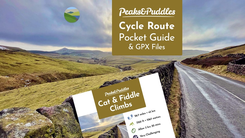
📒🧭 Cycle Route Pocket Guide + GPX Download for Cat & Fiddle Climbs.
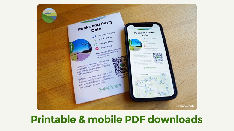
Get these handy downloads to take along for the ride, while helping to support the Peaks & Puddles website. The PDF Pocket Guide features simplified turn-by-turn directions, points of interest and an exclusive custom map which also shows recommended linking routes and more. Download in two formats: one for a nifty print-out paper guide, one to swipe through on your phone. Also includes GPX navigation files to plan or navigate as you go.
ABOUT THE RIDE
Cat & Fiddle Climbs — Very Challenging — Epic upon epic upon epic, a trio of strenuous but spectacular, classic hill climbs lead from the Cheshire mill town of Macclesfield up to the isolated Cat & Fiddle Inn, via the Brickworks, Windgather and Derbyshire’s Goyt Valley.
WHAT’S INCLUDED
• 📱 PDF Pocket Guide for phones (multi-page)
• 🖨️ PDF Pocket Guide for printing (single A4, double-sided)
• 🧭 GPX Track route file: Cat & Fiddle Climbs
• 🧭 GPX Track route file: Cat & Fiddle Climbs (Trentabank Tumble)
• 🧭 GPX Track route file: Cat & Fiddle Climbs (Goyt Start)
• 🧭 TCX Track route file: Cat & Fiddle Climbs
• 🧭 TCX Track route file: Cat & Fiddle Climbs (Trentabank Tumble)
• 🧭 TCX Track route file: Cat & Fiddle Climbs (Goyt Start)
• 🧭 FIT route file: Cat & Fiddle Climbs
• 🧭 FIT route file: Cat & Fiddle Climbs (Trentabank Tumble)
• 🧭 FIT route file: Cat & Fiddle Climbs (Goyt Start)
ABOUT THE POCKET GUIDE
The Pocket Guide is presented in two PDF formats: one designed for scrolling through on mobile devices, one designed for printing on A4 paper. Print it double-sided and the guide will fold up neatly to a quarter of the size, perfect to stick in a back jersey pocket.
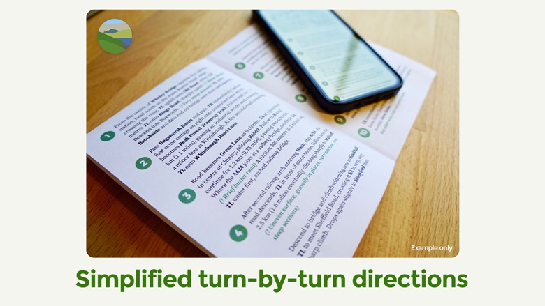
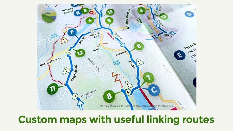
Each version includes simplified turn-by-turn directions and a custom-designed map, plus points of interest and trivia. The maps are created by myself especially for each guide, based on Open Street Map data but drawn from scratch to include both useful linking routes and potential alternative route options (where possible), which are also briefly described in the directions.
ABOUT THE GPX FILES
GPX, TCX and FIT files are all included, for the main route and any variations provided. The GPX route file(s) are the complete “GPX Track” type of file with thousands of entries to draw the correct route map. They can be imported onto a GPS device for turn-by-turn directions along the way or into online mapping services (eg Strava Route Planner, RidewithGPS) to view the route in detail. This is a useful guide to file formats: ridewithgps.com/help/export-file-formats
GET +, EXPLORE FURTHER
For the best value, become a Peaks & Puddles + supporter and get every download and exclusive route for a one-off contribution: ko-fi.com/s/b0df2c4ca1
THANK YOU
Your support is helping to pay the bills, cover costs and keep the free online route guides free for everyone.